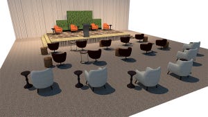
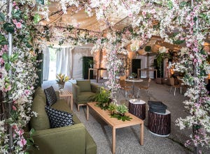
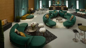
I am sitting here on what has to be the most beautiful day of the year in Santa Barbara, Calif. My crew is busy setting up a wedding tent in the lower lawn and tightening up the dance floor on the upper patio. I've just posted the CAD (computer-aided design) layouts for the table setup and started to think of the old days — not so long ago — when we used those little green templates to lay out our events. Measuring has sure come a long way since then.
Today, we have the opportunity to use precise measurements to create 3-D CAD drawings that we can really rely upon to plan our events. At EventRents, we use 3-D walk-throughs to help our customers visualize the event during the planning stage, and we use 2-D versions both to ensure that everything in our design fits into the event space and to provide our crew leaders with setup drawings.
We have access to many wonderful CAD programs specifically designed for the event industry such as PartyCAD, Vivien, VectorWorks, etc. I happen to use PartyCAD, but regardless of which CAD program you use, you still have to go through the site and measure it.
I have used all of the traditional hand-measuring devices — tape measures, rolling wheels, etc. — but using these tools is time-intensive. It is also difficult to take good measurements with these tools alone because event sites are so irregular in shape. Most event sites don't have a typical square or rectangular event space, especially the backyards of private homes. They are often free-flowing with trees, fountains and other obstacles that make it more of a challenge. In such cases, I turn to two methods to speed up the diagramming process: 1) Use an existing architectural diagram or landscape plan of the property, or 2) Use satellite imagery.
Using an existing architectural drawing works the best because all you need to do is digitize it by either scanning the image or taking a digital photo of it. I simply ask the owner or property manager if one is available. Once you have one known measurement within the space, you can easily trace the image in your CAD software. On larger spaces without existing diagrams, I've attempted to use Google Earth satellite images. But in most cases, this does not work very well. One reason is that the satellite is never exactly above the event site and so can give you a false measurement.
SPINES AND SPOKES
When diagrams or good satellite images are not available, it's back to the age-old hand-measurement method. However, we can now speed up this process using a specific measurement method and laser measuring tools. When measuring complicated free-flowing event spaces, I've used either the spine or spoke method.
With the spine method, I find an area at the center of the event space and measure a straight line from its two longest points. Then, I find the center of that line and measure across the horizontal axis. This gives me a great big “X” on my paper to start my diagram. From this center cross line, I walk about every 4 feet from the center and measure a line out to the perimeter. I repeat this to the ends of both sides, writing down each measurement. In the end, I have something that looks like a skeleton of the whole area with one spine and many ribs spaced 4 feet apart and a distance dimension on each rib.
The spoke method is a variation of the spine method; here, I stand in the center of the site while my partner pulls the measuring tape out from the center to the perimeter. At every 4 feet he walks around the perimeter, I record that measurement. In the end I have a diagram that looks like a lopsided wheel with spokes.
Armed with these measurements, I take this information to my CAD program and draw out the skeleton. After I replicate the skeleton in CAD, I then simply connect all of the end points to create the perimeter of the event space and then delete the skeleton to leave the outline of the event space in the drawing. I end up with a diagram of the entire useable perimeter of the event site.
I'd been doing this for a couple of years, and still many of my CAD attempts were not as perfect as I wanted them to be. So taking my previous trials into account, I came up with a solution that has given me a perfect measurement every time: laser charting.
LOOKING AT LASERS
Laser measurement devices allow me to measure in half the time with dead-on accuracy. The one I use is from Stanley. It measures about 100 feet and costs about $100.
To laser-chart, I use a laser measuring device and a 360-degree chart to define site details with pinpoint precision. I created a 360-degree measuring chart in PartyCAD with values set every 5 degrees. I had it enlarged to about 24 inches in diameter, then laminated and mounted the chart on a 2-by-2-foot board so it was large enough to work with and yet easy to carry around.
To use the 360-degree measuring chart, I stand in the middle of an event site and place my chart on whatever I see in the vicinity — an upside-down trash can, patio table or chair — it doesn't really matter.
While I stand at the charting point with the laser device, my partner walks the perimeter of the event space holding a 2-by-2-foot white board; white seems to work best for picking up the laser beam. I place the laser on the 360-degree chart and point it at the white board. Then, I move the laser 5 degrees at a time while he moves around the perimeter of the event space. This measures the property perfectly! In cases where there is less detail to be concerned with, you can move the laser every 10 degrees and finish the job in half the time.
Now, I still have to input these dimensions into my CAD program and create a perimeter line, but with these two tools, I end up with a perfect measurement while using less time and a simpler procedure. Using the laser and the 360-degree chart allows me to accurately place trees and other obstacles with no problems. And the laser also allows me to measure vertically, which has been very useful for measuring tree branches. In addition to creating your own 360-degree wheel, another option would be using a camera or telescope tripod with the 360-degree dial already built into the neck. The mounting hardware on the top of these tripods would easily hold a laser with Velcro, and the tripod itself is perfectly portable.
If you have questions about measuring sites or if you come up with the next great measuring tool, I'd love to hear from you!
Glenn Novack is project manager at EventRents in Santa Barbara, Calif. He can be reached at [email protected].